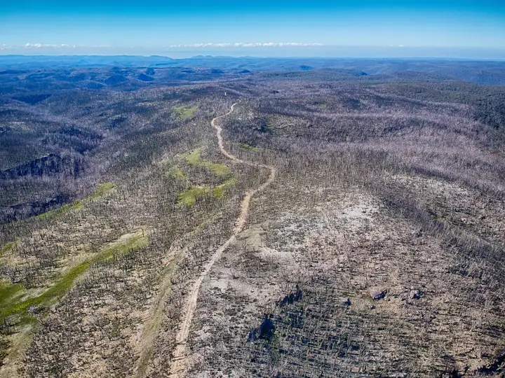
Mount Hay Road
A rough dirt road north from Leura across open heath to the Lockleys Pylon and Mount Hay trailheads, with Grose Valley views most of the way.
- Distanceabout 16km one-way
- Time40min each way
- Vehicle2WD with care
- Nearest townLeura
About this drive
Ten minutes from Leura Mall the bitumen ends and the road runs out along a narrowing ridge between the Grose Valley and Wentworth Creek. Walks to The Pinnacles, Lockleys Pylon, Butterbox Point and Mount Hay all start from pull-ins along it.
Surface: Unsealed, rocky and rutted in places. Vehicle: 2WD with care; high clearance recommended.
Route map
Mapped length 15.5 km. Route line from OpenStreetMap; distance and grade in the summary are the official NPWS figures where available.
Take this map offline
Phone reception drops out across most of the Mountains. Save the route before you leave town.
GPX opens in Gaia GPS, AllTrails, Organic Maps, Garmin and most navigation apps and shows your live position on the route with no signal. How to use offline maps.How to get there
From the Great Western Highway at Leura, turn north onto Mount Hay Road (opposite the Leura Mall exit) and keep going when the seal ends.
Parking: Pull-ins at each trailhead and a small carpark at the end.
Finish point: -33.63103, 150.40399 · directions to the end
Good to know
- Slow and bumpy rather than technical.
- Closed in total fire bans and after heavy rain at times.
Common questions
How long is Mount Hay Road?
Mount Hay Road is about 16km one-way and takes about 40min each way.
Where does Mount Hay Road start?
From the Great Western Highway at Leura, turn north onto Mount Hay Road (opposite the Leura Mall exit) and keep going when the seal ends. GPS: -33.71149, 150.33508.
Where do I park for Mount Hay Road?
Pull-ins at each trailhead and a small carpark at the end.
Do I need a 4WD for Mount Hay Road?
2WD with care; high clearance recommended. Unsealed, rocky and rutted in places.
Is there phone reception at Mount Hay Road?
Do not rely on it. Download the GPX file or save this page offline before you leave Leura.
Sources: OpenStreetMap contributors (route line). Last checked Thursday 12 November 2026. Spotted something out of date? Tell us.
Photo: Maksym Kozlenko, CC BY-SA 4.0.
