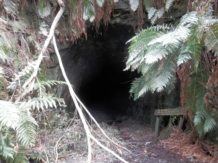
Glow Worm Tunnel Walking Track
Walk through an abandoned 400-metre railway tunnel on the Newnes Plateau, its walls lit by thousands of glow worms.
- Distance6km return
- Time2 - 3hrs
- DifficultyGrade 3 of 5
- Nearest townLithgow
About this walk
The tunnel was cut in 1907 for the Wolgan Valley Railway, which hauled shale oil out of Newnes. The rails are long gone and glow worms have moved in. Walk to the middle, turn off your torch, stay quiet and let your eyes adjust.
The track to the tunnel passes pagoda rock formations and tree ferns and was rebuilt with a new carpark and boardwalk, which is why the walk is longer than older guides say.
Route map
Mapped length 1.7 km. Route line from OpenStreetMap; distance and grade in the summary are the official NPWS figures where available.
Take this map offline
Phone reception drops out across most of the Mountains. Save the route before you leave town.
GPX opens in Gaia GPS, AllTrails, Organic Maps, Garmin and most navigation apps and shows your live position on the route with no signal. How to use offline maps.How to get there
From Lithgow, take State Mine Gully Road north onto the Newnes Plateau and follow Glow Worm Tunnel Road to the carpark - about 35 km, mostly unsealed. Allow at least an hour from Lithgow. See our Glow Worm Tunnel Road page for the drive.
Parking: Glow Worm Tunnel carpark at the end of Glow Worm Tunnel Road.
Good to know
- Bring a torch for every walker - the tunnel floor is uneven and wet.
- Keep torches off the glow worms and voices low, or they switch off.
- No phone reception for most of the drive. Download the offline map before you leave Lithgow.
Common questions
How long is Glow Worm Tunnel Walking Track?
Glow Worm Tunnel Walking Track is 6km return and takes about 2 - 3hrs.
How hard is Glow Worm Tunnel Walking Track?
It is rated Grade 3 on the Australian Walking Track Grading System: suitable for most ages and fitness levels, with some steps and short steep sections.
Where does Glow Worm Tunnel Walking Track start?
From Lithgow, take State Mine Gully Road north onto the Newnes Plateau and follow Glow Worm Tunnel Road to the carpark - about 35 km, mostly unsealed. Allow at least an hour from Lithgow. See our Glow Worm Tunnel Road page for the drive. GPS: -33.23916, 150.22749.
Where do I park for Glow Worm Tunnel Walking Track?
Glow Worm Tunnel carpark at the end of Glow Worm Tunnel Road.
Can I take my dog to Glow Worm Tunnel Walking Track?
No. Dogs and other pets are not permitted in NSW national parks, including on leads or in vehicles.
Is there phone reception at Glow Worm Tunnel Walking Track?
Do not rely on it. Download the GPX file or save this page offline before you leave Lithgow.
Sources: NSW National Parks and Wildlife Service (distance, time, grade, coordinates); OpenStreetMap contributors (route line). Last checked Thursday 12 November 2026. Spotted something out of date? Tell us.
Photo: Gonzo Gooner, CC BY 3.0.
